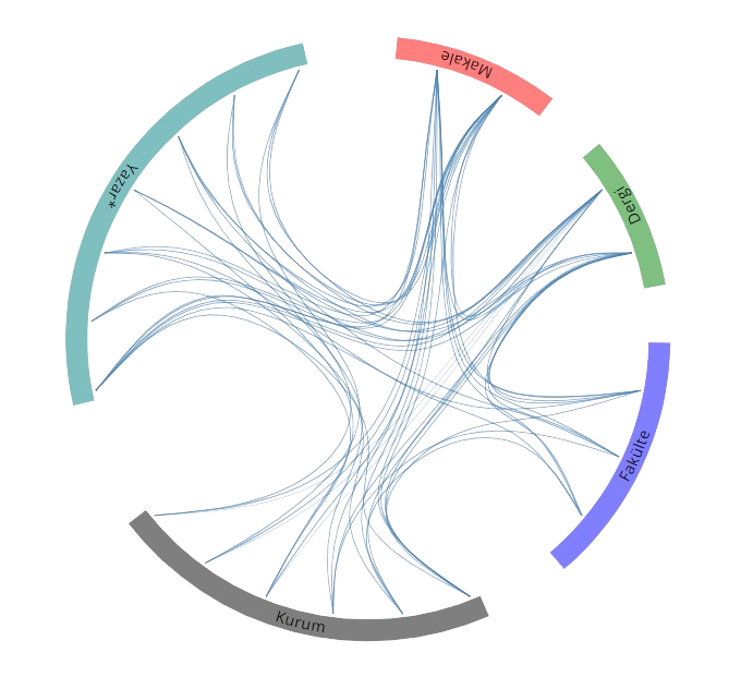
Yayınlar & Eserler

SCI, SSCI ve AHCI İndekslerine Giren Dergilerde Yayınlanan Makaleler

Diğer Dergilerde Yayınlanan Makaleler

Hakemli Kongre / Sempozyum Bildiri Kitaplarında Yer Alan Yayınlar

Kentsel Taşkın Risk Değerlendirmesinde CBS ve Bayes Ağlarının Entegrasyonu

11. Uluslararası Mühendislik Mimarlık ve Tasarım Kongresi, Türkiye, 10 - 12 Haziran 2023

İzmir-Çiğli’de Işık Kirliliğinin Belirlenmesi

TMMOB 7. Coğrafi Bilgi Sistemleri Kongresi, Ankara, Türkiye, 03 Ekim 2022

Coğrafi Bilgi Sistemleri ve Çok Ölçütlü Karar Analizi Kullanılarak Rüzgâr ve Dalga Enerji Sistemleri İçin Yer Seçimi

4th International Symposium on Innovative Approaches in Engineering and Natural Sciences (ISAS WINTER-2019), Samsun, Türkiye, 22 Kasım 2019

Morphometric Analysis of the Sakarya Basin Stream Network Using Linear Morphometric Indices and Fractal Analysis

International Symposium on Applied Geoinformatics (ISAG-2019), İstanbul, Türkiye, 07 Kasım 2019

Mekânsal Planlama ve Karar Problemlerinde CBS ve Bayes Ağlarının Entegrasyonu

TMMOB Coğrafi Bilgi Sistemleri Kongresi, Türkiye, 23 - 25 Ekim 2019

Kızılırmak Havzası Drenaj Ağının ve Alt Havza Sınırlarının Uzaktan Algılama ve CBS İle Otomatik Çıkarımı

2nd International Symposium on Innovative Approaches in Scientific Studies (ISAS 2018-Winter), 30 Kasım 2015 - 02 Aralık 2018

Automatic Extraction of River Drainage Network and Sub-basin Boundaries of Kızılırmak Basin Using Remote Sensing and GIS

2nd International Symposium on Innovative Approaches in Scientific Studies, 30 Kasım - 02 Aralık 2018

Kentsel Büyümenin Modellenmesi ve Simülasyon Modelleri

2nd International Symposium on Innovative Approaches in Scientific Studies, 30 Kasım - 02 Aralık 2018

Samsun-Atakum Orman Alanlarının Belirlenmesinde Farklı Bitki İndekslerinin Karşılaştırılması

2nd International Symposium on Innovative Approaches in Scientific Studies, 30 Kasım - 02 Aralık 2018

Türkiye Orman Alanlarının 2000-2017 Periyodunda Mekânsal-Zamansal Değişim Analizi

2nd International Symposium on Innovative Approaches in Scientific Studies (ISAS 2018-Winter), 30 Kasım - 02 Aralık 2018

Kentsel Yayılmadaki Zamansal Değişimlerin Fraktal Analiz Kullanılarak İncelenmesi: Arnavutköy Örneği

2nd International Symposium on Innovative Approaches in Scientific Studies, 30 Kasım - 02 Aralık 2018

Investigation of Coastline Changes of Samsun-Turkey Using Remote Sensing and GIS

2nd International UNIDOKAP Black Sea Symposiumon Biodiversity, 28 - 30 Kasım 2018

Determination of Vegetation Cover in Samsun-Turkey Using NDVI

2nd International UNIDOKAP Black Sea Symposiumon Biodiversity, 28 - 30 Kasım 2018

Change and Trend Analysis of Annual Total Precipitation in Samsun-Turkey

2nd International UNIDOKAP Black Sea Symposiumon Biodiversity, 28 - 30 Kasım 2018

Determination of Land Use/Cover Changes of Kucuk Menderes Basin in Turkey

2nd International UNIDOKAP Black Sea Symposiumon Biodiversity, 28 - 30 Nisan 2018

Natural Environment And Fractal Geometry

3. International Conference on Civil and Environmental Engineering, 24 - 27 Nisan 2018

Determination of Snow Cover from Landsat-8 Satellite Images using Normalized Difference Snow Index

3. International Conference on Civil and Environmental Engineering, 24 - 27 Nisan 2018

Determination of Shoreline of Kızılırmak Delta and Lagoons using Pan-sharpened NDWI and MNDWI Water Indexes

3. International Conference on Civil and Environmental Engineering, 24 - 27 Nisan 2018

Spatio-temporal Hazard Assessment: Bayesian Network Approach

3. International Conference on Civil and Environmental Engineering, 24 - 27 Nisan 2018

Tokat İlinde Kentsel Büyümenin SLEUTH Modeli İle Simülasyonu

1st International Symposium on Innovative Approaches in Scientific Studies, 11 - 13 Nisan 2018

Integration of Bayesian Networks and GIS for Dynamic Avalanche Assessment: NSDI Perspective

UCTEA International Geographical Information Systems Congress 2017, 15 - 18 Kasım 2017

Fractal Analysis of Coastal Pattern of the Kızılırmak Delta and Lagoons

UCTEA International Geographical Information Systems Congress 2017, 15 - 18 Kasım 2017

Fractal Analysis in Geomorphology

INTERNATIONAL SYMPOSIUM ON GIS APPLICATIONSIN GEOGRAPHY GEOSCIENCES, Çanakkale, Türkiye, 18 - 21 Ekim 2017

From Euclidean to Fractal Geometry in Geography and Geosciences

INTERNATIONAL SYMPOSIUM ON GIS APPLICATIONSIN GEOGRAPHY GEOSCIENCES, Çanakkale, Türkiye, 18 - 21 Ekim 2017

Fractal Analysis of the Lagoons in the Kızılırmak Delta

19th International Symposium on Environmental Pollution and its Impact on Life in the Mediterranean Region, Roma, İtalya, 4 - 06 Ekim 2017

Fraktal Analizin Yeryüzü Araştırmalarında Kullanılması

TUFUAB IX. Teknik Sempozyumu, Türkiye, 27 Nisan - 29 Haziran 2017

Shannon Entropi ve Fraktal Analiz İle Kentsel Yayılmanın İncelenmesi: Samsun Örneği

16. Türkiye Harita Bilimsel ve Teknik Kurultayı, Türkiye, 3 - 06 Mayıs 2017

Çorum İli Taşkın Tehlikesinin Analitik Hiyerarşi Yöntemi Kullanılarak İncelenmesi

16. Türkiye Harita Bilimsel ve Teknik Kurultayı, Ankara, Türkiye, 3 - 06 Mayıs 2017, cilt.1

Shoreline Change Analysis For Kizilirmak Lagoon Series

ICZM 2014: 3rd International Symposium on Integrated Coastal Zone Management, Antalya, Türkiye, 14 - 17 Ekim 2014

Çoklu Etmen Sistemleri ve CBS nin Entegrasyonu

5. Uzaktan Algılama-CBS Sempozyumu (UZAL-CBS 2014), İstanbul, Türkiye, 14 - 17 Ekim 2014

Kızılırmak Deltası Kıyı Çizgisinin Zamansal Değişimi

5. Uzaktan Algılama-CBS Sempozyumu (UZAL-CBS 2014), İstanbul, Türkiye, 14 - 17 Ekim 2014

Evaluating the Impacts of Land Use Cover and Rainfall Changes on Surface Runoff by Using Remote Sensing and GIS

ICOEST 2014: 2nd International Conference on Environmental Science and Tecnology, Antalya, Türkiye, 14 - 17 Mayıs 2014

Determination of Spatio temporal Changes in Vegetation Cover By Using Different Vegetation Indices Based on Remote Sensing Data

ICOEST 2014: 2nd International Conference on Environmental Science and Tecnology, Antalya, Türkiye, 14 - 17 Mayıs 2014

Geo statistical Interpolation of Meteorological Data in Aegean Region Turkey

ISDS 2014: 9th International Statistics Day Symposium, Antalya, Türkiye, 10 - 14 Mayıs 2014

GIS based Analytical Hierarchy Process for Spatial Decision Problems

ISDS 2014: 9th International Statistics Day Symposium, Antalya, Türkiye, 10 - 14 Mayıs 2014

Analysing the Effects of Land Use Land Cover Changes on Rainfall Runoff by Using Remote Sensing and GIS A Case Study South Marmara Basin

RSPSoc Annual Conference 2013: Earth Observation for Problem Solving, Glasgow, İngiltere, 4 - 06 Eylül 2013

Configuration of Development Planning Business Process within the Scope of Turkish National Geographic Information System TNGIS for Turkey

IMCW2013: 4th International Symposium on Information Management in a Changing World, Limerick, İrlanda, 4 - 06 Eylül 2013

Terrestrial Laser Scanning for 3D Documentation of Historical and Cultural Artifacts

IMCW2013: 4th International Symposium on Information Management in a Changing World, Limerick, İrlanda, 4 - 06 Eylül 2013

Analysis of Temporal Changes in Samsun Turkey Vegetation by Using Different Vegetation Indices and Comparison of Vegetation Indices

RSPSoc Annual Conference 2013: Earth Observation for Problem Solving, Glasgow, İngiltere, 4 - 06 Eylül 2013

Hücresel Otomat Markov Zinciri Yöntemiyle Samsun Kıyı Alanlarındaki Mekansal Değişimlerin Modellenmesi

14. Türkiye Harita Bilimsel ve Teknik Kurultayı, Ankara, Türkiye, 14 - 16 Mayıs 2013

CBS Tabanlı Çok Ölçütlü Karar Analizi Sıralı Ağırlıklı Ortalama SAO Yöntemi ve Samsun Atakum İçin Potansiyel Otopark Alanlarının Seçimi

Cumhuriyet Üniversitesi Geomatik Mühendisliği Bölümü Açılış Sempozyumu, Sivas, Türkiye, 17 - 19 Kasım 2011

GIS based Multi criteria Decision Analysis GIS MCDA The Ordered Weighted Averaging OWA Approach

21st International Conference on Multiple Criteria Decision Making, Jyvaskyla, Finlandiya, 13 - 17 Haziran 2011

Technique for order preference by similarity to ideal solution (Topsis) for spatial decision problems

7th International Symposium on Geo-information for Disaster Management, Gi4DM 2011, Antalya, Türkiye, 3 - 08 Mayıs 2011 identifier

GIS Based Decision Support Systems for Integrated Water Resources Management

International Sustainable Water and Wastewater Management Symposium, Konya, Türkiye, 26 - 28 Ekim 2010, cilt.1, ss.139-144

Integration of Geographical Information Systems and Multi Criteria Decision Analysis

2nd International Symposium on Information Management in a Changing World, Ankara, Türkiye, 22 - 24 Eylül 2010

Meteorolojik Verilerin CBS ve Çok Değişkenli İstatistiksel Analiz Yöntemleriyle Konumsal Enterpolasyonu

Uluslararası Katılımlı I. Meteoroloji Sempozyumu, Ankara, Türkiye, 27 - 28 Mayıs 2010

Metrikler

Yayın

101

Atıf (WoS)

269

H-İndeks (WoS)

8

Atıf (Scopus)

294

H-İndeks (Scopus)

7

Proje

1

Tez Danışmanlığı

12

Açık Erişim

8
BM Sürdürülebilir Kalkınma Amaçları